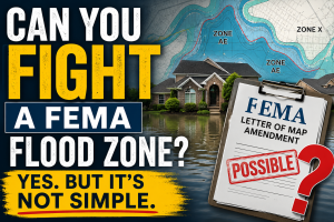
Flood zones are land areas identified by the Federal Emergency Management Agency (FEMA). Each area of land is mapped and labeled into a flood zone. FEMA flood maps include zones that are broken into several areas.
Here are the most common flood zone areas that you will see in Missouri:
Search St Louis Homes For Sale HERE
- Zone AE. Zone AE is an area that has a 1 % probability of flooding each and every year, which is why it is commonly referred to as the “100 year flood plain”. These areas are considered to be at high risk of flooding. There is a 26% chance that the property will flood over the life of a 30 year mortgage.
- Zone X (shaded). Zone X shaded is an area that has a 0.2% to 1% probability of flooding each and every year. This is the area located between the 100 year flood plain and the 500 year flood plain. These areas are considered to be at a moderate risk of flooding. These areas are typically areas protected by a levee, or an area located near Zone AE that is very flat and has less than 1 foot of drainage depth per one square mile.
- Zone X (unshaded). Zone X unshaded is an area that has less than a 0.2% chance of flooding, commonly known as the 500 year flood plain. This area is considered to be at minimal risk of flooding.
Keep in mind that EVERY property is located in a flood zone. It’s just a matter of which flood zone you’re in and whether or not there is any risk associated with being located in that zone. Working with a professional Land Surveyor is the key to attaining the proper information. You can visit www.FEMA.gov for more information regarding FEMA flood maps and flood zones.
Shelly Clark is the President of Cardinal Surveying, a family owned land surveying company. The company was established in 2003 and has completed over 10,000 projects spanning the greater St Louis area. Licensed in Missouri, they currently service St Charles, St Louis, Warren, Lincoln, and Jefferson Counties. Cardinal Surveying specializes in residential and commercial surveying, including Boundary Surveys, Surveyor’s Real Property Reports, ALTA Surveys and Elevation Certificates. Rated A+ by the Better Business Bureau for the past 7 years, their service, product, and professionalism are sure to meet every client’s needs. You can contact Shelly at 636-922-1001 or visit the company website at CardinalSurveying.com.