After floating the Current River recently, we stopped at Blue Spring on the drive home.
Photos do not prepare you for it.
The color looks almost artificial at first, an impossible blue that barely seems real until you stand next to it. Then there is the sound. Millions of gallons of water surge from the spring every day after traveling underground through the limestone beneath Missouri.
Standing there, it struck me how much of this state is shaped by things most of us never see.
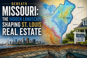
In Missouri, some of the most important forces shaping the landscape are happening underground, and strangely enough, some of those same hidden systems quietly influence real estate across parts of the St. Louis region too.
Missouri’s underground landscape is far more complex than many residents realize. The state’s geology includes extensive limestone formations, karst terrain, caves, springs, and underground drainage systems that shape how water moves beneath the surface.
Missouri Department of Natural Resources Interactive Geological Map
Most buyers spend their time thinking about schools, commute times, kitchens, and interest rates. Very few spend much time thinking about what exists beneath the house itself. But Missouri’s geology is unusual, and in some areas, it matters more than people realize.
Much of Missouri sits on limestone terrain known as karst topography. Over thousands of years, water slowly dissolves limestone, creating underground drainage systems, caves, springs, sinkholes, and voids beneath the surface.
Missouri is famous for it. The state has thousands of documented caves and sinkholes, along with some of the most beautiful spring systems in the country. In southern Missouri, those systems create places like Blue Spring, Alley Spring, Round Spring, and the crystal-clear rivers that make the Ozarks feel almost cinematic in certain light.
But the same underground geology that creates breathtaking natural beauty can also influence how land behaves closer to home.
Parts of the St. Louis region contain karst features, historic mining areas, quarries, and complex groundwater movement that most homeowners never think about unless something suddenly draws attention to it.
None of this means buyers should become overly anxious about karst geology every time they purchase a home in Missouri. Most properties will never experience major geological problems. But understanding the landscape can help explain why drainage, grading, water movement, and site conditions matter so much in certain areas.
Water follows gravity, pressure, cracks, and paths of least resistance whether those pathways are visible or not. Sometimes that simply creates drainage challenges. In other cases, it contributes to erosion, settling, or shifting soil conditions that homeowners may not fully understand until years later, and because so much of this happens underground, homeowners often have little awareness of it until a problem appears.
That invisible quality is part of what makes Missouri geology so fascinating.
The Missouri Geological Survey maintains an interactive sinkhole map that reveals just how widespread karst features are across parts of the state, including areas within the greater St. Louis region.
Even nearby properties can experience very different drainage behavior depending on soil conditions, elevation changes, and what exists beneath the surface.
Sometimes that means engineering around stormwater. Sometimes it influences where subdivisions are practical to build. In other cases, it affects how roads, retaining walls, or foundations are designed.
In certain parts of Missouri, rivers themselves disappear underground temporarily before resurfacing miles away. That sounds fictional until you start exploring the state and realizing how much of Missouri’s identity is tied to water moving through rock.
The Meramec, Current, Jacks Fork, and countless smaller waterways are all part of systems that have been shaping this landscape long before roads, subdivisions, or municipal boundaries ever existed, and in many ways, real estate simply adapts around those systems whether people recognize them or not.
Ironically, the same geology that creates concerns in some places is also part of what makes Missouri visually extraordinary. The springs, bluffs, caves, rivers, and rolling terrain that people travel across the country to experience are all connected to the same underground limestone systems beneath the state.
That connection feels easy to forget when discussing real estate because homes naturally focus our attention upward: the roof, the kitchen, the finishes, the neighborhood, but Missouri is one of those places where the story underneath the home matters too. Not necessarily in a fear-driven way, but certainly in a fascinating one. Sometimes the landscape people see is only part of the story. Some of the forces shaping homes, neighborhoods, rivers, development patterns, and drainage behavior across Missouri have been quietly moving underground for thousands of years.

Karen Moeller
STLKaren.com
Karen.McNeill@STLRE.com
314.678.7866
About the Author:
Karen Moeller is a St. Louis area REALTOR® with MORE, REALTORS® and a regular contributor to St. Louis Real Estate News, helping clients make informed, data-driven decisions.